Our Berlin is five kilometres wide
Seventy per cent of the places in this guide sit within five kilometres of Alexanderplatz. Berlin is forty-five kilometres across. Every claim we make about the city is really a claim about a small circle in the middle of it, and here is the shape of that circle.
Any guide is a sample. Most of them do not say so, and almost none of them show you the sample.
Our corpus holds 192 mapped places. The median distance from Alexanderplatz to one of them is 3.4 kilometres. Seventy per cent of them, 134, sit inside a five-kilometre circle. Berlin measures roughly 45 kilometres from its western edge to its eastern one, so the circle that holds most of this guide would fit across the city nine times.
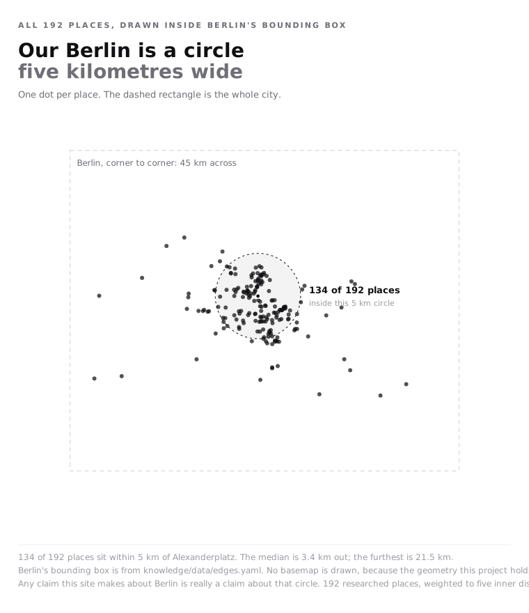
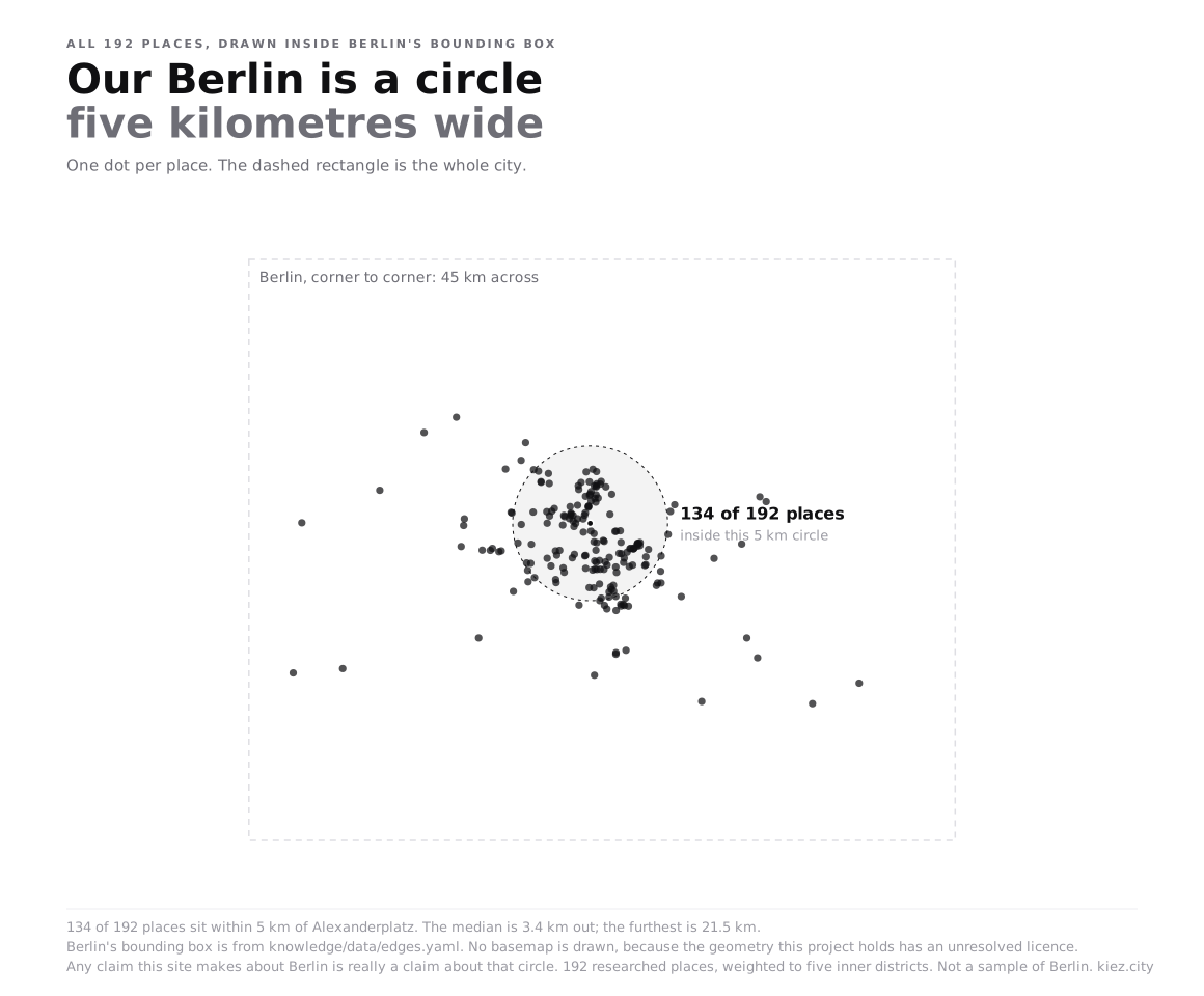
Every mapped place in the corpus, drawn inside Berlin's bounding box. Full size.
Where the coverage stops
The falloff is not gradual. Counting places in one-kilometre rings outward from Alexanderplatz, the count holds up to about six kilometres and then collapses.
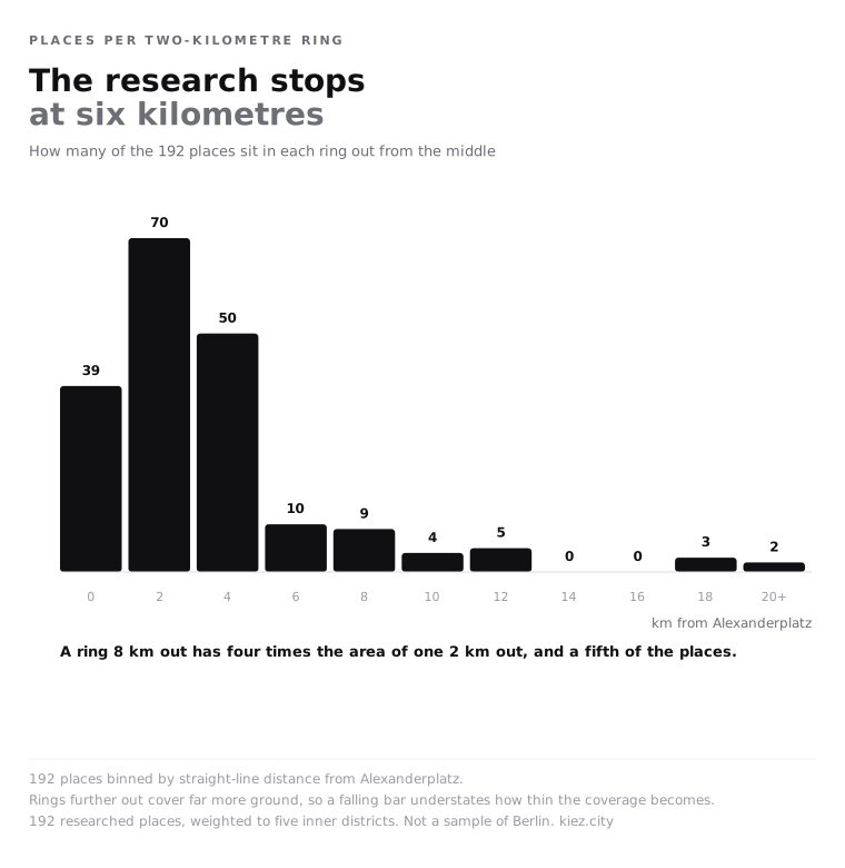
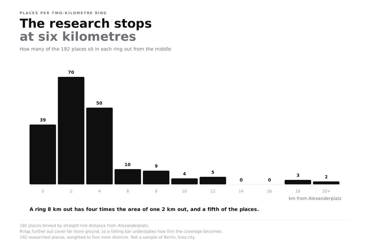
Places per one-kilometre ring from Alexanderplatz. Full size.
The outer entries exist, and they are almost all the same kind of thing: lakes, gardens, a tower, a zoo. Müggelsee, Pfaueninsel, the Britzer Garten, Tegeler See. The furthest place in the corpus is 21 kilometres out. Berlin has plenty of restaurants at that distance and the corpus has none, because the research went looking for landmarks past a certain radius and for daily life inside it.
Five research areas hold 140 of the 192 places, which is 73%. Kreuzberg has 30, Prenzlauer Berg 28, Mitte 28, Friedrichshain 27, Neukölln 27. The remaining eleven areas share 52 between them. Spandau has two.
The research points south
Distance is only half of the shape. The other half is direction, and the corpus has a strong one.
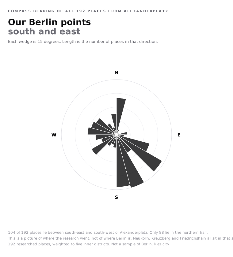
Compass bearing of all 192 places from Alexanderplatz, in fifteen-degree wedges. Full size.
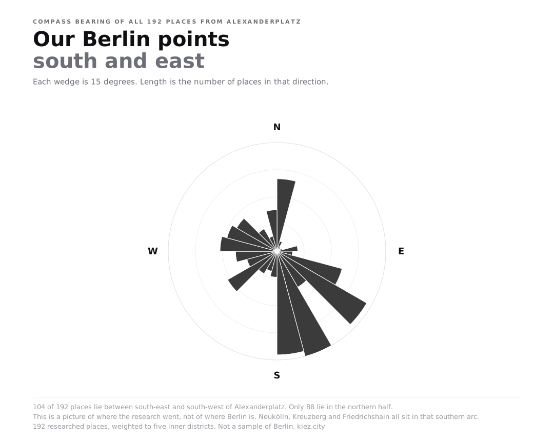
A hundred and four of the 192 places lie in the southern half, between south-east and south-west. Eighty-eight lie in the northern half. That is not a dramatic imbalance until you look at where the missing ones would be: exactly three places in the whole corpus sit north-east of Alexanderplatz, in the direction of Weissensee, Hohenschönhausen and Marzahn.
The southern bias has an obvious cause. Neukölln, Kreuzberg and Friedrichshain all sit in that arc, and those three areas alone contribute 84 places. Anyone reading a Berlin recommendation from this site is reading a recommendation from the southern inner city, stated or not.
The gap inside the gap
The distribution above is uneven. The writing on top of it is far more uneven than that, and this is the number we like least.
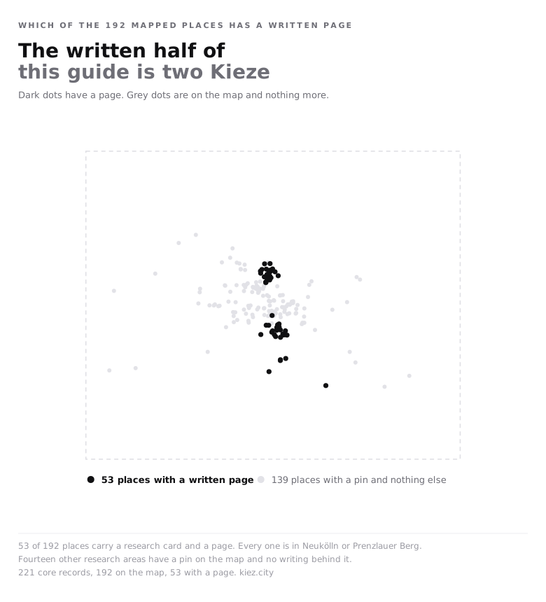
Places with a full researched page, by area. Full size.
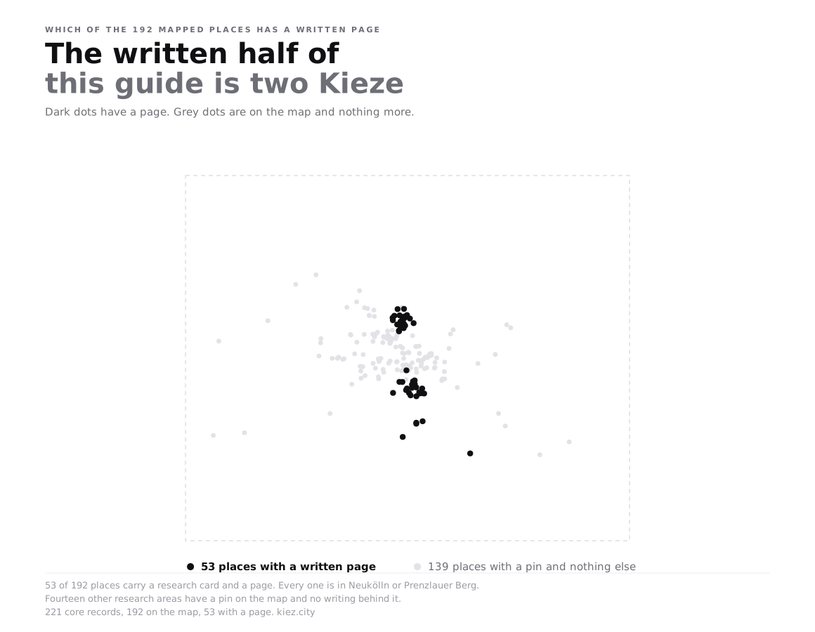
Fifty-three places have a full page: sourced hours, a price where one exists, a description drawn from something dated. Twenty-seven of them are in Neukölln. Twenty-six are in Prenzlauer Berg. The number for Kreuzberg is zero, for Mitte zero, for Friedrichshain zero, and for everywhere else zero.
That is not a judgement about those areas. It is an artefact of how the research ran: two areas were taken to full depth as a pilot, the rest were recorded as sourced one-liners, and the run ended before the pattern was repeated. The honest consequence is that a district guide written off any area other than Neukölln or Prenzlauer Berg would be a guide written off one-line summaries, and we do not publish those.
Forty-three of the 221 records in the research corpus have no coordinates at all. They are dropped from the map rather than estimated, which is why the mapped count is 192 and not 221. Guessing a location from a name is how a guide ends up putting a bar in the wrong district and never finding out.
Why publish this
Because the alternative is worse. A guide that shows 192 dots on a map of Berlin invites the reading that it covers Berlin, and it does not. The circle above is the actual claim: a dense inner core, a thin outer ring of large landmarks, two areas with real writing behind them and fourteen without.
Everything else on this site should be read against that shape. When a chart here says that Berlin's places cluster 263 metres apart, or that 94% of them are within 400 metres of a transit stop, those are statements about the circle. The outer city is genuinely less dense and genuinely less well served, and this sample cannot show you either fact, because it barely goes there.
The about page carries the running counts of what failed during collection, which is the other half of the same disclosure.